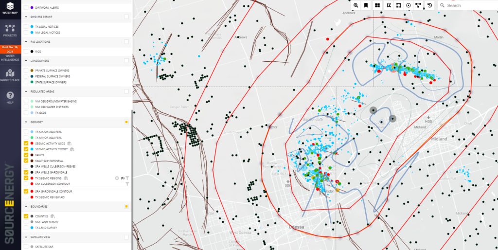
Sourcenergy has built in new features and capabilities into their platform to help tackle the challenges of induced seismicity and the recent Texas Railroad Commission restrictions in and around “Seismic Response Areas” (SRA).
Here’s a look at the Gardendale SRA as set by the Texas Railroad Commission.

- The red oval lines represent the geographical Gardendale seismic regions and contour lines within the SRA
- The dark brown lines represent known fault lines along with fault slip potentials
- The blue and red dots represent known seismic activity
- The black dots are SWD locations
Sourcenergy identifies the disposal wells affected by these new restrictions within the SRA along with details such as total amount of produced water (barrels per day) impacted on a well by well basis.
In addition, you can see which disposals — in and outside of the SRA — are still available to handle more produced water.
Request a free demo of our platform to help you manage these new challenges affecting where you can transport and dispose of your produced water.
Sourcenergy. Pioneering Energy Intelligence.